


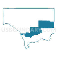
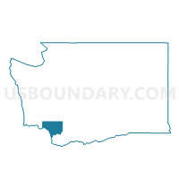
Tunstall Voting District, Cowlitz County, Washington
About
Outline

Summary
| Unique Area Identifier | 684072 |
| Name | Tunstall Voting District |
| County | Cowlitz County |
| State | Washington |
| Area (square miles) | 184.54 |
| Land Area (square miles) | 183.96 |
| Water Area (square miles) | 0.59 |
| % of Land Area | 99.68 |
| % of Water Area | 0.32 |
| Latitude of the Internal Point | 46.12493510 |
| Longtitude of the Internal Point | -122.51687930 |
Maps

Graphs
Select a template below for downloading or customizing gragh for Tunstall Voting District, Cowlitz County, Washington


Neighbors
Neighoring Voting District (by Name) Neighboring Voting District on the Map
- Carrolls South Voting District, Cowlitz County, WA
- Kalama North Voting District, Cowlitz County, WA
- Lewis River Voting District, Skamania County, WA
- Modrow Voting District, Cowlitz County, WA
- Rose Valley Voting District, Cowlitz County, WA
- Vincent Voting District, Cowlitz County, WA
- Woodland Heights Voting District, Cowlitz County, WA
- Yale Voting District, Cowlitz County, WA
Top 10 Neighboring County Subdivision (by Population) Neighboring County Subdivision on the Map
- Longview-Kelso CCD, Cowlitz County, WA (63,510)
- Woodland CCD, Cowlitz County, WA (10,923)
- Kalama CCD, Cowlitz County, WA (6,330)
- Rose Valley CCD, Cowlitz County, WA (5,169)
- Rainier CCD, Columbia County, OR (4,257)
- Northeast Cowlitz CCD, Cowlitz County, WA (1,689)
- North Skamania CCD, Skamania County, WA (98)
Top 10 Neighboring Place (by Population) Neighboring Place on the Map
Top 10 Neighboring Unified School District (by Population) Neighboring Unified School District on the Map
- Kelso School District, WA (28,482)
- Woodland School District, WA (11,971)
- Rainier School District 13, OR (7,405)
- Kalama School District, WA (6,354)
- Stevenson-Carson School District, WA (6,199)
Top 10 Neighboring State Legislative District Lower Chamber (by Population) Neighboring State Legislative District Lower Chamber on the Map
- State House District 18, WA (160,083)
- State House District 15, WA (132,788)
- State House District 31, OR (62,690)
Top 10 Neighboring State Legislative District Upper Chamber (by Population) Neighboring State Legislative District Upper Chamber on the Map
- State Senate District 18, WA (160,083)
- State Senate District 15, WA (132,788)
- State Senate District 16, OR (122,983)
Top 10 Neighboring 111th Congressional District (by Population) Neighboring 111th Congressional District on the Map
Top 10 Neighboring Census Tract (by Population) Neighboring Census Tract on the Map
- Census Tract 16, Cowlitz County, WA (6,330)
- Census Tract 17, Cowlitz County, WA (5,169)
- Census Tract 9703, Columbia County, OR (4,257)
- Census Tract 15.01, Cowlitz County, WA (3,005)
- Census Tract 18, Cowlitz County, WA (1,689)
- Census Tract 3, Cowlitz County, WA (509)
- Census Tract 9501, Skamania County, WA (98)
Top 10 Neighboring 5-Digit ZIP Code Tabulation Area (by Population) Neighboring 5-Digit ZIP Code Tabulation Area on the Map
- 98632, WA (49,205)
- 98626, WA (24,523)
- 98674, WA (12,029)
- 97048, OR (6,691)
- 98625, WA (6,133)
- 98603, WA (1,017)
- 98616, WA (150)